FLYOK
  • Home
  • EVENTS
  • Sites
    • FLY HILLS
    • El Nido, Clearwater, BC
  • Visiting Pilots
  • Do It!
  • Forum/Members
    • Join/Renew
    • Forum
    • Gallery
    • Gallery Archive
  • Resources
    • Resource Tools
    • Safety
    • FAQs
    • LINE Chat Setup
  • About/Contact
  • Blog
  • KING EDDY AND BALDY

Resources

Weather

  • Canada RASP
  • Environment Canada BC Forcasts
  • Nav Canada Aviation Weather
  • XC Skies
  • XC Skies Surface Winds Chart
  • Weather Spark
  • All Winds on the Planet
    **New!
Picture

GeoData

  • Google Maps/Earth
  • NRCan Tools/Geogratis
  • CanMaps Topo Charts
  • Backroad Mapbooks


Picture

Pilot Tools

  • HPAC.ca
  • Hanggliding.org
  • Paragliding.org
  • Paragliding Forum
  • Jérôme Daoust's PG Pilot Tips
Smartphone Tools
  • Paragliding Map (iPhone/Android)
  • XC Track (Android)
  • FlySkyHy (iPhone)
  • iVariometer (iPhone)
  • Glympse (iPhone/Android)
  • What3Words (iPhone/Android)
  • SAS Survival Guide (iPhone/Android)
  • Cell411 Help Button
    (iPhone/Android)
  • see below for app details...

General Information

  • Cross Country Magazine
  • USHPA Magazine
  • British Columbia Societies Act
Picture

Smartphone Tips

One of the most useful pilot tools of late is the smartphone. Being light and portable it is perfect for the free flyer. Some app suggestions apear above under Pilot Tools, there are more below. Here are some thoughts to consider for yours...

  • Carry a small backup battery. The phone is a brick without power and Murphy says your battery will be dead when you land out on a long XC. Even a solar charger is better than none but it is limited.
  • Bring your cable! I go to fly-ins and meets and there is always someone missing a charger/connection cable. Remember yours. Keep two in case one gets lost or gives up the ghost. Keep an extra one in your harness.
  • Get good GPS/Navigation apps. Google maps is a good start but requires a connection and will do you no good out of cell range or you're travelling (roaming charges are vicious). Good Nav apps are worth their cost. I use GPS Kit for iphone and TomTom but you can check reviews on various apps for your phone to get the one you want or fits your needs. TomTom is a bit pricey but all the maps are 'on-the-phone' so no cell connection needed and it paid for itself on overseas trips as it beeped advanced warnings on roadways whenever we approached speed cameras.
  • PDF Filler app. On the road I have gone to the local club websites and downloaded their waivers/visiting pilot membership pdf forms and filled them out (with signature) right on the phone and emailed them back instantly. (Good to get the paperwork out of the way without a printer.)
  • When coming across good general information on a sign or leaflet, use your phone's camera to capture it. Metro maps & schedules, passports, tickets etc. are valuable reference backups on your phone's camera roll.
  • Use your To-Do list app to hold checklists. Especially when travelling and on launch, there is ALWAYS something forgotten. Head that off with a good pre-made checklist.
Picture
PG Map Site Guide
Picture
iVariometer

Glympse

Picture
Glympse.com  (iPhone/Android) 
https://glympse.com/get-glympse-app/
​https://vimeo.com/213891861
Want your crew to know how close you are so they will wait for you before heading up to launch without you? Landed out and need to tell your driver where you are but can't see any road signs?

A google pin is stationary. If you are moving, get a ride, hiking in/out, Glympse is excellent. If allows you to send your live location to recipients for a specified amount of time. 'Bob sees me for the next 2.5 hours.' The recipient does not need the glympse app, they get a link to the website with a live moving map display.

Glympse Map
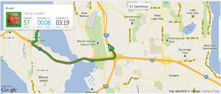
Glympse: What the recipient sees in their browser

What3Words

Picture
https://what3words.com
​https://www.youtube.com/watch?v=JTy7C47I8w0
​(iPhone/Android)
Google pins, Glympses, GPS coords work fine if you are within cell data coverage. If you have strayed out of that coverage and only have radio communication (or the recipient does not have data access) then relaying a string of GPS coordinates vocally is problematic and prone to mistakes/missed numbers. Only one wrong number can put the search miles away from you.

​What3Words has assigned every 3sq.m. on the planet with three unique words. Just utter those three words for your spot and the recipient knows your location by 3 meters without ambiguity. Worked multiple times brilliantly for us.  
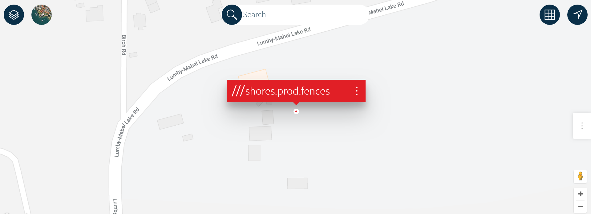
Picture

Cell411 Emergency Help Button

Picture
https://getcell411.com/
http://youtube.com/watch?v=R6Rzj0UC6Uw
(iPhone/Android)

​Get help from friends fast! ​Cell 411 allows you to create custom cells or groups of your friends, neighbors or family members and alert them whenever you need help; they will receive your exact location with turn-by-turn directions to come and assist you.


Documents to put on your phone...

Your phone is a reader. Make sure that you have a good PDF app like GoodReader (iPhone) and store these:

  • Glider Manual. (Good for those spec references you can never remember but some numbers obsessed guy just has to ask you.)
  • Radio Manual. (Way too often a wrong key is pressed and now your radio is in some cryptic mode that you can't get out of. This ALWAYS happens on launch when conditions are awesome and you're leading visitors.)
  • Vario/GPS Manuals. (See Radio Manual comment)
  • Reserve Manual. (If you ever have to pull or it falls out on launch or you do a water landing, you will need to repack. Remember the steps? Chances are one of these occur when you are travelling.)
  • First Aid guide. (Best be safe and emergencies are when you forget all that stuff)
  • SAS Survival Guide. (iPhone/Android)(Has First Aid and sooooo much more)
  • Local Pilot contact lists & Emergency numbers. (When available on local club sites I grab the list and keep it in my reader.)

Line (group communications on-the-go)

Picture
Line is the app that we use for field communications where radio/texting/calling won't cut it. It is a Chat/Skype/IM type of app that has gained excellent ground over the past couple of years. It is great for flying/travel coordination and it's free!

It is especially helpful for novices and visiting pilots who don't necessarily know who the active pilots are and when/where they are going.

OSA chose line because of it's:
  • Platform Coverage (All smartphone/tablet OS's covered as well as PC & Mac) 
  • Acceptance (100,000 users in its first 8 months means it is well supported and will not be shutting down soon)
  • Group chat capabilities (much trickier with texting)
  • Board section for posting longer term reference items
  • Comm formats (Text/Voice/Image/Video/Geo-location)
  • As an app, you can choose to turn on/off notifications so it is not invasive.
  • Easy to use.
Read more about features here.

Line is a Chat/Skype/IM type of app that has gained excellent ground over the past year. It is available for ALL smartphone platforms so that iPhone/Android/Blackberry/Windows phones can all participate. There are even PC and Mac versions. 


Pilots who want to join the FlyOKPG or FlyOKHG chat groups, follow these steps (note: Pilots and Drivers ONLY! Spammers will be refused):

  1. Download the app for FREE from your device's app store by searching for LINE or LINE CHAT (look for the green LINE logo)(**ipad users be sure to select iphone apps)
  2. Register by using either your cell phone number or a Facebook account
  3. Once active, Add a friend using the HEAD+ button and search (using the magnifying glass button) for FLYOK. Add FLYOK and send a message specifying your interest in either FlyOKHG or the FlyOKPG group, or both (or the specific region you will be flying. If you don't specify and request we cannot put you in.)
    ***NOTE: You cannot search for groups, you MUST be invited.
  4. When your request is received you will be invited to the group and will be sent a join request (which should happen within 24 hours, usually minutes.)
  5. When the Friends button has a red badge on it select it, select the group under GROUP INVITATIONS and hit the JOIN button and you're in.

How do I use it and what for?
  • Any messages sent to the group will be received by the whole FlyOKHG or FlyOKPG group. Be judicious with this but it will be useful
  • You can also send messages to individuals in the group by selecting their Avatar, great for private messages
  • You can create your own groups for just your party and driver coordination
  • Many types of messaging formats: Text/Voice clips/Voice Dialogue/Image/Video
  • You can announce/request items of general issues or general member info, post weather conditions, safety issues, pilot reminders, your landing coords for available drivers, etc. Be aware that you are messaging the whole pilot community so keep it relevant. Otherwise select an individual's avatar and speak directly to that individual.
  • As an app, you can alter the app's general notification settings or you can silence notifications on specific groups within the app itself so you only get notifications when you want them, which is great when not flying. No need to leave a group or uninstall the app, just silence it. Use the upper right chevron menu to 'Notifications off/on'
  • There is a search function for your entire chat list (not available within a chat or group.) In the list of chats/groups, pull down and a search bar will be revealed (IOS/Android at least, have not tested other platforms.) The search will bring up all chats with the search text and bring you to the point within the chat as well.

**If you don't have a smartphone, the pilot next to you probably will so don't be afraid to ask them to post or check something for you.
**There is a geolocation option but it is not very accurate. Use Glympse or What3Words instead...


IGC/GPX to KML/KMZ Converter - the Maddy Home

Picture
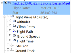
Submit your flight's IGC or GPX file and receive a Google Earth file representing your flight. You may see your flight path as a simple, one-color path, or colorized based on altitude, climb/descent rate, ground speed, or air speed. The KML file can include all five and you can interactively view each representation in Google Earth.

Check it out.

Picture
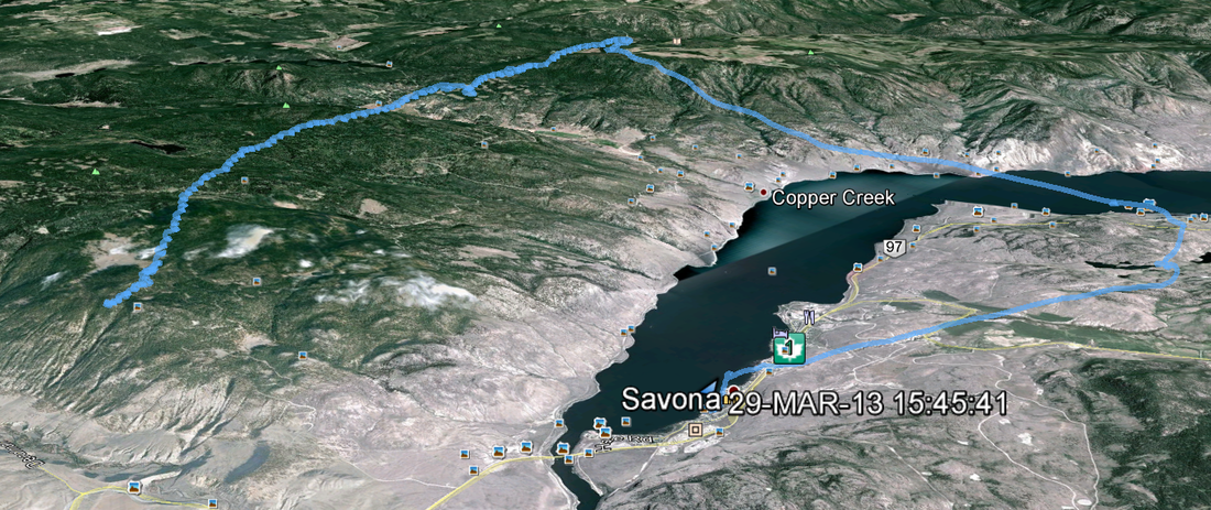
Regular GPX track brought into Google Earth
Picture
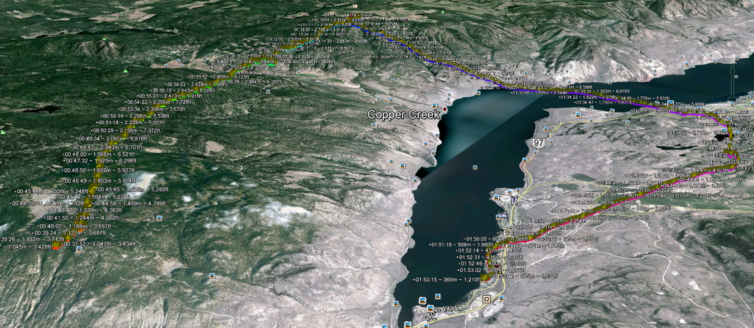
GPX converted to KML by MaddyHome Coverter

Intermediate/Advanced Pilot Info

PG & HG: Ten Tips For Comp Flying

From XC Magazine
Powered by Create your own unique website with customizable templates.