EVENTS FOR 2020 |
EL NIDO FLY-IN Clearwater B.C.
Moderator: Willy Rens
You are invited to join the 12th Annual El Nido Fly-In at Clearwater B.C.
OPEN TO HANGLIDER AND PARAGLIDER PILOTS
HPAC MANDATORY PLEASE HAVE IT AVAILABLE
YouTube:
Watch Terry Butcher’s video on how to catch the house thermal up
https://www.youtube.com/watch?v=pBxFcGofCtc&t=53s
Watch Bill Nikolai’s video
https://www.youtube.com/watch?v=MJ-K2h4i1us
SCHEDULE OF EVENTS
Friday July 31st
10 am: pilots meeting at LZ across from Dee’s General Store at Birch
Island, site and weather briefing and pilot contact info exchange
Organize transportation to Launch
11 am -
7 pm: Flying! All day! As far and as high as you can!
9 pm: Bonfire at Willy and Sigi’s place BYOB
1088 Bohill Place
Saturday August 1st
10 am: pilot’s meeting at LZ, weather briefing, organize transportation
to launch
11 am -
7 pm: fly all day
9 pm: bonfire at Willy and Sigi’s BYOB
Sunday August 2nd
Same schedule as previous days
Monday August 3rd
10 am: pilots meeting at LZ weather briefing, organize transportation to
launch
11 am -
7 pm: fly all day
Directions to LZ : The LZ is at Dee’s General store in Birch Island. From the info center in Clearwater take the HWY 5 North (direction Jasper) for 12 Km – 8 min. Take a right @ Birch Island Lost Creek Road and follow the road (500m) down to ‘Dee’s General store”. Look for happy people.
Elevation: Take Off = 1030 m / 3380 ft ASL
Landing = 460 m / 1510 ft ASL
Vertical drop = 570 m / 1870 ft
Orientation: South
Type of flying: Ridge soaring and thermal XC
Landing: Big field in front of ‘Dee’s General store’ in Birch Island
Take off: 4 gliders can set up at once, nice grassy gentle slope located in a wide cut block
Directions to launch:
From LZ drive back up to HWY 5. Drive North (direction Jasper). After 4 km take a left onto a gravel road (Mc Corvy Lakes FSR). Stay on this main gravel road for 6.5 km and ignore the small junctions. At 6.5 km look for a windsock in the trees on your left side. Take a left onto this narrow level road. Follow this for 1 km and you will drive by the launch. Park next to the road, NOT on the launch area.
Event Frequency = 140.100
Cell phone reception is ‘reasonably good’ at the flying site!!
COVID 19 RECOMMENDATIONS
To keep everyone healthy and safe we all have to do our due diligence in avoiding the spread of COVID-19. If you have been travelling outside of Canada or have been to an area with high CORONA numbers, if you have been sick or are experiencing symptoms in the last 2 weeks, or have been around someone that has been diagnosed with CORONA VIRUS or is symptomatic please STAY HOME
Recommended during interaction:
- Keep the 2 meter physical distancing as much as possible.
- Washing hands frequently. Bring hand-sanitizer.
- Avoiding physical contact: No handshaking, no hugging, no Belgian kisses!-Avoid touching your eyes, nose and mouth.
During transportation to launching area:
Those who volunteer to drive pilots up to the launching area, consider limiting the number of people in the truck to 3, max 4 keeping maximum distance. Loading pilots in the cargo box outside the cab is at your discretion.
- Disinfect your truck on a daily basis.
- Use alcohol-based hand sanitizer before entering the truck.
- While driving up in the truck, use a face-mask or buff covering mouth and nose
El Nido (Clearwater - BC)
Site name = El Nido
Direction of Launch: South. Site Suitable for: HG & PG
Type of Site: Mountain flying Type of Flying: Ridge soaring and Thermal XC
Elevation Launch: 3380’ asl (1030 m). Elevation Lz: 1510’ asl (460 m).
Vertical Drop: 570 m / 1870 ft
XC Potential: Good in spring and Summer
Heading South to Barriere (55 km) or Kamloops (107 km).
Heading North to Blue River (90 km) or Valemount (165 km)
Insurance: Open to all free flyers with HPAC insurance. MANDATORY!!!
Location: Clearwater BC 124 kilometers north of Kamloops
On the Yellowhead Hyw #5, in Central British Columbia
Vehicle / Transportation Requirements:
2 wheel cars with a higher ground clearance and 4 wheel Drive will make it up easily. Parking @ TO.
Flying Season: Assign value 0, 1, 2, 3 or 4 (highest)
Spring 3 Summer 4 Fall 2. Winter 0
HPAC Skill Level Recommendations:
Mild Conditions: Student & Novice = April, September, October
Moderate Conditions: intermediate = August
Strong Conditions: Advanced = May, June, July
Mornings are good from April till October.
Site Regulation: HPAC insurance MANDATORY!!
Avoid flying over houses.
Close gate @ LZ
Directions to LZ:
From the info center in Clearwater take the HWY 5 North (direction Jasper) for 12 Km – 8 min. Take a right @ Birch Island Lost Creek Road and follow the road (500m) down to ‘Dee’s General store”. Look for happy people....and a windsock.
Description of LZ:
Humongous field (75 Acres) in front of Dee’s General store at Birch Island.
Directions to Launch:
A good gravel road leads you up to TO.
From LZ drive back up to HWY 5. Drive North (direction Jasper). After 4 km take a left onto a gravel road (Mc Corvy Lakes FSR) Stay on this main gravel road for 6.5 km and ignore the small junctions. At 6.5 km look for a windsock in the trees on your left side. Take a left onto this narrow level road. Follow this for 1 km and you will drive by the TO. Park next to the road, NOT on the TO.
Description of Launch:
Grassy launch
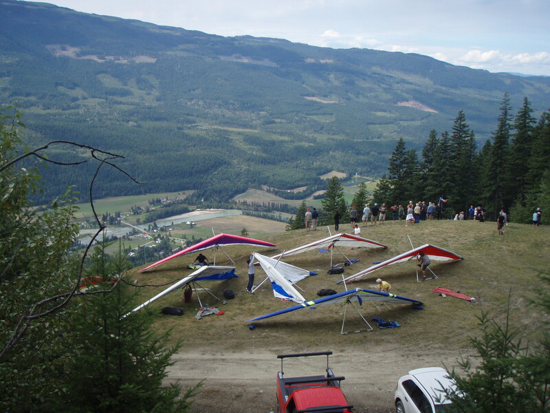
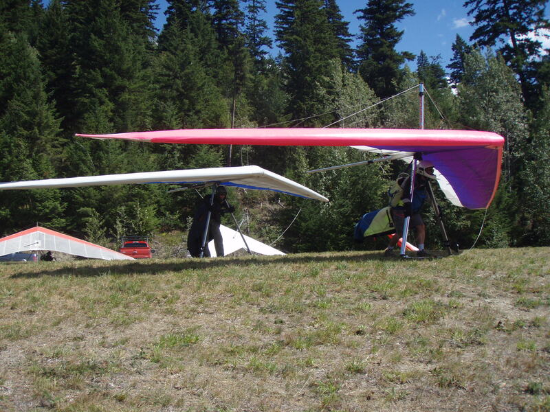
4 gliders can set up at once, nice grassy gentle slope located in a wide cut block
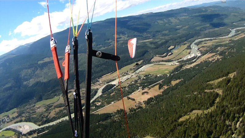
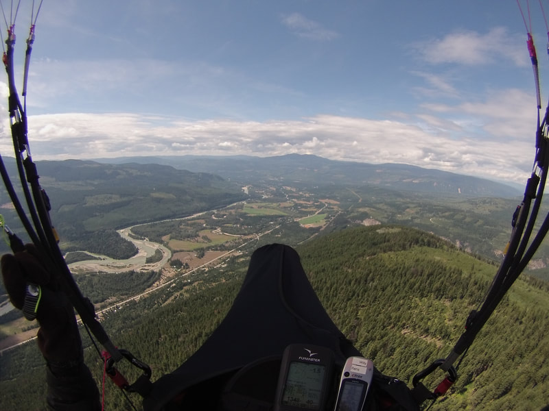
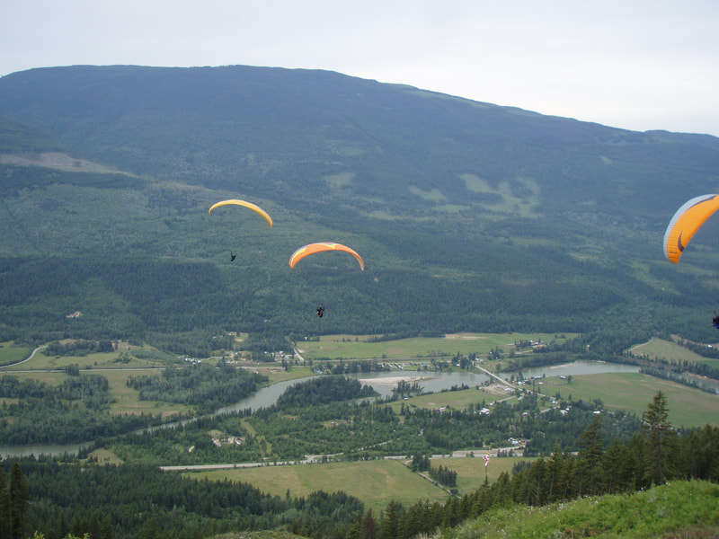
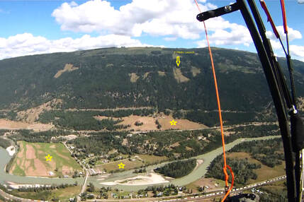
Photo = At 2500 m ASL above the TO with the LZ in the left of the picture, heading for Clearwater town.
Times to Fly:
8.00 AM till 11.00 AM = gentle morning conditions for short (15 – 30 min) flights.
11.00 AM till 4.00 PM = Thermal flying conditions. On certain days it gets to strong @ TO between 1.00 and 4.00 PM!
4.00 PM till 7.00 PM = Thermal / glass off conditions.
Soaring Information
Para gliders and Hang gliders welcome.
A great site for long thermal/soaring flights above/along the 12 km long ridge between Clearwater and Vavenby.
Very favourable for hang gliders as well with a steep TO and humongous landing field.
Often the ceiling sits around + 3000 m in May, June, July and August with lots of pilots flying 30 km triangles or local XC. The potential is to fly big XC if you follow the hwy 5 North towards Blue River (90 km) or Valemount (165 km) or head South towards Barrier (55km) or keep going all the way to Kamloops (107 km).
The local house thermal sits just right from TO above the small cut-blocks.
Hazards :
Strong TO conditions between 1.00 and 4.00 PM on certain days!!!
ALWAYS make a good wind assessment at TO. If you experience moments of tailwind @ TO, it’s a sign of 90 deg valley winds! Be aware that the thermals still coming up straight at times but the real issue is the valley winds creating turbulence form the high trees either from the right (West) or left (East) during TO!!!
Be aware that there is a local helicopter company as well as recreational sport aircraft's who, on a regular base, fly through the valley!!!
Flight rules:
We are in ‘uncontrolled airspace’. Visual flight rules apply.
By definition we can fly from SFC to 14500 ft / 4420 m MSL.
Radio Frequency:
Glider Pilot to Glider pilot = 140.100.
Aviation Radio Frequency / glider pilot to local air traffic = 123.200 MHz.
Weather info
Canada Rasp:http://www.canadarasp.com/RASPtable.html
Windgrams:http://www.canadarasp.com/windgrams/
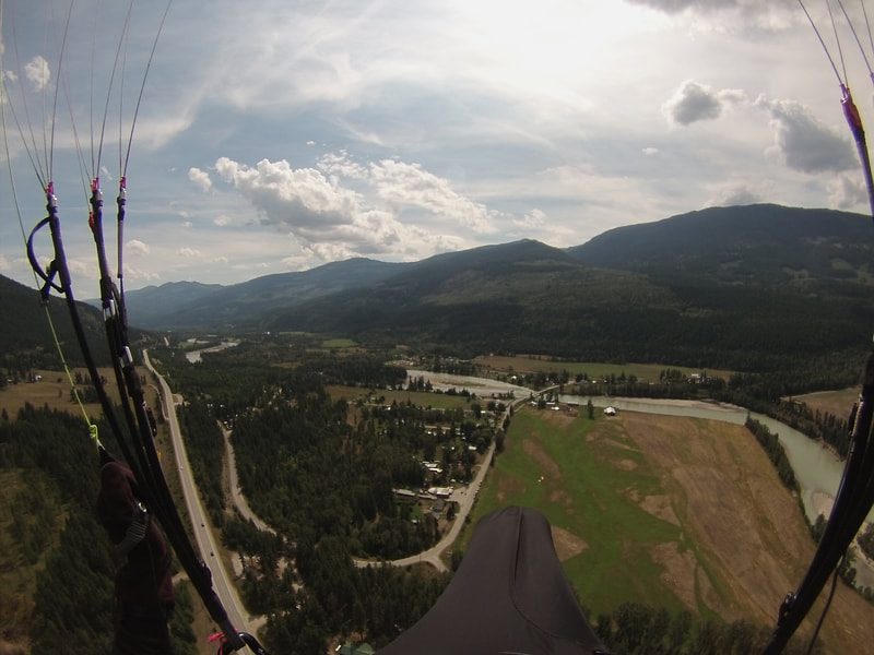
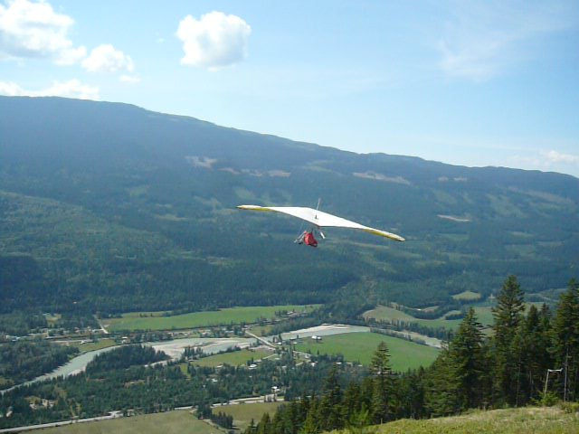
Photo = Looking at the town of Birch Island from TO.
Additional Information:
Cell phone reception is moderately good at the flying site!!
Site Records as of 2019:
Altitude Gain: 3040 m (4040 ASL- July 2018)
Duration: 6.20h (Scott Watwood)
Open Distance: 92 km El Nido to Blue River (Scott Watwood PG – May 2017), 55 km Barriere to El Nido (Scott Watwood PG –May 2017), 52 km Kamloops to Barriere (Terry Butcher PG – summer 2014), 55 km El Nido to Avola (Mark Parminter & Eric Gesinger PG – July 2018), 65 km El Nido to Barriere (John Theoret HG – July 2018), 61 km El Nido to Mesitner Pass (Mario Sachsenweger & Willy Rens PG – Aug 2019),
Out & Return:
Triangle: 42 km (Peter Spear PG - August 2016), 45 km (Willy Rens PG – June 2018), 66 km (Mark Tulloch HG – July 2018)
Accomodation:
Clearwater is an adventure – tourism town with plenty of accommodation possibilities form Camping to B&B to hotel. Pick what your body likes best.
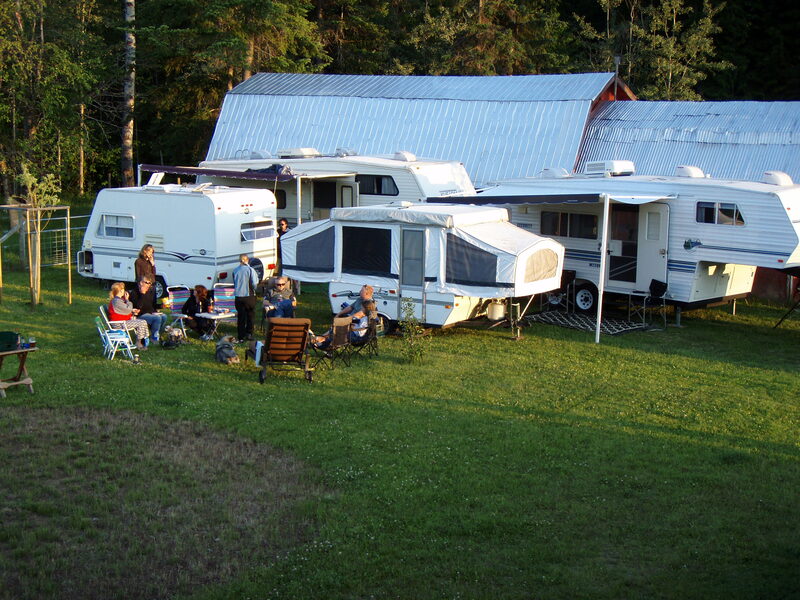
Camping offer: Exclusively for the ‘ El Nido Fly In weekend there is free camping around Willy & Sigi’s house @ 1088 Bohill Place Clearwater BC
At the end of each flying day you are invited to join the great campfire place at Sigi and Willy’s place where we can get together and tell stories....perhaps with a beer. BBQ available to cook your steak. Bring your own!!!
Due to the Covid-19 we ask you to stay outside the house. There will be an outhouse that can be used but kitchen or bathroom are unavailable. So, if you bring your own kitchen, bathroom and bedroom you are welcome to stay for free at our place. Electric is available.
Alternatively you can stay at one of the many accommodations that Clearwater has to offer.
Recreational activities
- Wild water rafting and kayaking on the famous Clearwater river.
- Horse riding
- Amazing waterfalls in the hidden gem of BC... Wells Grey Provincial Park and see also: http://www.explorewellsgray.com/
- Swimming, canoeing and relaxing on Dutch Lake in down town Clearwater
- Canoeing on Clearwater Lake (70 km from Clearwater)
- Hiking in the Alpine of the Trophy Mtns... And last but not least PARAGLIDING.
Tourism Information:
www.xskyparagliding.com
Clearwater Adventure Tourism
Travel BC Canada for Clearwater
Explore Wells Gray Provincial Park
North Thompson Valley Association
Clearwater & District Chamber of Commerce
Clearwater Restaurants
‘The Painted Turtle' = stylish great dining with a great view of the mountains on the shore of Dutch Lake (in town of Clearwater )
'The Hop and Hog' = Most busy place in town with fresh beer and smoked pork. 300 m from the Wells Grey Information Centre on the Clearwater Valley Road (in town of Clearwater)
El Nido Annual Fly-In:
This is a relaxed get together flying weekend...fly high, fly long, enjoy.
A great site for long thermal/soaring flights along/above the 12 km long ridge.
Para gliders and Hang gliders welcome.
El Nido Fly-In / local Contacts:
Sigi and Willy: [email protected]
(cell) 1 250 674 1108
Thanks
Willy
Moderator: Willy Rens
You are invited to join the 12th Annual El Nido Fly-In at Clearwater B.C.
OPEN TO HANGLIDER AND PARAGLIDER PILOTS
HPAC MANDATORY PLEASE HAVE IT AVAILABLE
YouTube:
Watch Terry Butcher’s video on how to catch the house thermal up
https://www.youtube.com/watch?v=pBxFcGofCtc&t=53s
Watch Bill Nikolai’s video
https://www.youtube.com/watch?v=MJ-K2h4i1us
SCHEDULE OF EVENTS
Friday July 31st
10 am: pilots meeting at LZ across from Dee’s General Store at Birch
Island, site and weather briefing and pilot contact info exchange
Organize transportation to Launch
11 am -
7 pm: Flying! All day! As far and as high as you can!
9 pm: Bonfire at Willy and Sigi’s place BYOB
1088 Bohill Place
Saturday August 1st
10 am: pilot’s meeting at LZ, weather briefing, organize transportation
to launch
11 am -
7 pm: fly all day
9 pm: bonfire at Willy and Sigi’s BYOB
Sunday August 2nd
Same schedule as previous days
Monday August 3rd
10 am: pilots meeting at LZ weather briefing, organize transportation to
launch
11 am -
7 pm: fly all day
Directions to LZ : The LZ is at Dee’s General store in Birch Island. From the info center in Clearwater take the HWY 5 North (direction Jasper) for 12 Km – 8 min. Take a right @ Birch Island Lost Creek Road and follow the road (500m) down to ‘Dee’s General store”. Look for happy people.
Elevation: Take Off = 1030 m / 3380 ft ASL
Landing = 460 m / 1510 ft ASL
Vertical drop = 570 m / 1870 ft
Orientation: South
Type of flying: Ridge soaring and thermal XC
Landing: Big field in front of ‘Dee’s General store’ in Birch Island
Take off: 4 gliders can set up at once, nice grassy gentle slope located in a wide cut block
Directions to launch:
From LZ drive back up to HWY 5. Drive North (direction Jasper). After 4 km take a left onto a gravel road (Mc Corvy Lakes FSR). Stay on this main gravel road for 6.5 km and ignore the small junctions. At 6.5 km look for a windsock in the trees on your left side. Take a left onto this narrow level road. Follow this for 1 km and you will drive by the launch. Park next to the road, NOT on the launch area.
Event Frequency = 140.100
Cell phone reception is ‘reasonably good’ at the flying site!!
COVID 19 RECOMMENDATIONS
To keep everyone healthy and safe we all have to do our due diligence in avoiding the spread of COVID-19. If you have been travelling outside of Canada or have been to an area with high CORONA numbers, if you have been sick or are experiencing symptoms in the last 2 weeks, or have been around someone that has been diagnosed with CORONA VIRUS or is symptomatic please STAY HOME
Recommended during interaction:
- Keep the 2 meter physical distancing as much as possible.
- Washing hands frequently. Bring hand-sanitizer.
- Avoiding physical contact: No handshaking, no hugging, no Belgian kisses!-Avoid touching your eyes, nose and mouth.
During transportation to launching area:
Those who volunteer to drive pilots up to the launching area, consider limiting the number of people in the truck to 3, max 4 keeping maximum distance. Loading pilots in the cargo box outside the cab is at your discretion.
- Disinfect your truck on a daily basis.
- Use alcohol-based hand sanitizer before entering the truck.
- While driving up in the truck, use a face-mask or buff covering mouth and nose
- Be respectful to others in this matter. We are in this together.
El Nido (Clearwater - BC)
Site name = El Nido
Direction of Launch: South. Site Suitable for: HG & PG
Type of Site: Mountain flying Type of Flying: Ridge soaring and Thermal XC
Elevation Launch: 3380’ asl (1030 m). Elevation Lz: 1510’ asl (460 m).
Vertical Drop: 570 m / 1870 ft
XC Potential: Good in spring and Summer
Heading South to Barriere (55 km) or Kamloops (107 km).
Heading North to Blue River (90 km) or Valemount (165 km)
Insurance: Open to all free flyers with HPAC insurance. MANDATORY!!!
Location: Clearwater BC 124 kilometers north of Kamloops
On the Yellowhead Hyw #5, in Central British Columbia
Vehicle / Transportation Requirements:
2 wheel cars with a higher ground clearance and 4 wheel Drive will make it up easily. Parking @ TO.
Flying Season: Assign value 0, 1, 2, 3 or 4 (highest)
Spring 3 Summer 4 Fall 2. Winter 0
HPAC Skill Level Recommendations:
Mild Conditions: Student & Novice = April, September, October
Moderate Conditions: intermediate = August
Strong Conditions: Advanced = May, June, July
Mornings are good from April till October.
Site Regulation: HPAC insurance MANDATORY!!
Avoid flying over houses.
Close gate @ LZ
Directions to LZ:
From the info center in Clearwater take the HWY 5 North (direction Jasper) for 12 Km – 8 min. Take a right @ Birch Island Lost Creek Road and follow the road (500m) down to ‘Dee’s General store”. Look for happy people....and a windsock.
Description of LZ:
Humongous field (75 Acres) in front of Dee’s General store at Birch Island.
Directions to Launch:
A good gravel road leads you up to TO.
From LZ drive back up to HWY 5. Drive North (direction Jasper). After 4 km take a left onto a gravel road (Mc Corvy Lakes FSR) Stay on this main gravel road for 6.5 km and ignore the small junctions. At 6.5 km look for a windsock in the trees on your left side. Take a left onto this narrow level road. Follow this for 1 km and you will drive by the TO. Park next to the road, NOT on the TO.
Description of Launch:
Grassy launch
4 gliders can set up at once, nice grassy gentle slope located in a wide cut block
Photo = At 2500 m ASL above the TO with the LZ in the left of the picture, heading for Clearwater town.
Times to Fly:
8.00 AM till 11.00 AM = gentle morning conditions for short (15 – 30 min) flights.
11.00 AM till 4.00 PM = Thermal flying conditions. On certain days it gets to strong @ TO between 1.00 and 4.00 PM!
4.00 PM till 7.00 PM = Thermal / glass off conditions.
Soaring Information
Para gliders and Hang gliders welcome.
A great site for long thermal/soaring flights above/along the 12 km long ridge between Clearwater and Vavenby.
Very favourable for hang gliders as well with a steep TO and humongous landing field.
Often the ceiling sits around + 3000 m in May, June, July and August with lots of pilots flying 30 km triangles or local XC. The potential is to fly big XC if you follow the hwy 5 North towards Blue River (90 km) or Valemount (165 km) or head South towards Barrier (55km) or keep going all the way to Kamloops (107 km).
The local house thermal sits just right from TO above the small cut-blocks.
Hazards :
Strong TO conditions between 1.00 and 4.00 PM on certain days!!!
ALWAYS make a good wind assessment at TO. If you experience moments of tailwind @ TO, it’s a sign of 90 deg valley winds! Be aware that the thermals still coming up straight at times but the real issue is the valley winds creating turbulence form the high trees either from the right (West) or left (East) during TO!!!
Be aware that there is a local helicopter company as well as recreational sport aircraft's who, on a regular base, fly through the valley!!!
Flight rules:
We are in ‘uncontrolled airspace’. Visual flight rules apply.
By definition we can fly from SFC to 14500 ft / 4420 m MSL.
Radio Frequency:
Glider Pilot to Glider pilot = 140.100.
Aviation Radio Frequency / glider pilot to local air traffic = 123.200 MHz.
Weather info
Canada Rasp:http://www.canadarasp.com/RASPtable.html
Windgrams:http://www.canadarasp.com/windgrams/
Photo = Looking at the town of Birch Island from TO.
Additional Information:
Cell phone reception is moderately good at the flying site!!
Site Records as of 2019:
Altitude Gain: 3040 m (4040 ASL- July 2018)
Duration: 6.20h (Scott Watwood)
Open Distance: 92 km El Nido to Blue River (Scott Watwood PG – May 2017), 55 km Barriere to El Nido (Scott Watwood PG –May 2017), 52 km Kamloops to Barriere (Terry Butcher PG – summer 2014), 55 km El Nido to Avola (Mark Parminter & Eric Gesinger PG – July 2018), 65 km El Nido to Barriere (John Theoret HG – July 2018), 61 km El Nido to Mesitner Pass (Mario Sachsenweger & Willy Rens PG – Aug 2019),
Out & Return:
Triangle: 42 km (Peter Spear PG - August 2016), 45 km (Willy Rens PG – June 2018), 66 km (Mark Tulloch HG – July 2018)
Accomodation:
Clearwater is an adventure – tourism town with plenty of accommodation possibilities form Camping to B&B to hotel. Pick what your body likes best.
Camping offer: Exclusively for the ‘ El Nido Fly In weekend there is free camping around Willy & Sigi’s house @ 1088 Bohill Place Clearwater BC
At the end of each flying day you are invited to join the great campfire place at Sigi and Willy’s place where we can get together and tell stories....perhaps with a beer. BBQ available to cook your steak. Bring your own!!!
Due to the Covid-19 we ask you to stay outside the house. There will be an outhouse that can be used but kitchen or bathroom are unavailable. So, if you bring your own kitchen, bathroom and bedroom you are welcome to stay for free at our place. Electric is available.
Alternatively you can stay at one of the many accommodations that Clearwater has to offer.
Recreational activities
- Wild water rafting and kayaking on the famous Clearwater river.
- Horse riding
- Amazing waterfalls in the hidden gem of BC... Wells Grey Provincial Park and see also: http://www.explorewellsgray.com/
- Swimming, canoeing and relaxing on Dutch Lake in down town Clearwater
- Canoeing on Clearwater Lake (70 km from Clearwater)
- Hiking in the Alpine of the Trophy Mtns... And last but not least PARAGLIDING.
Tourism Information:
www.xskyparagliding.com
Clearwater Adventure Tourism
Travel BC Canada for Clearwater
Explore Wells Gray Provincial Park
North Thompson Valley Association
Clearwater & District Chamber of Commerce
Clearwater Restaurants
‘The Painted Turtle' = stylish great dining with a great view of the mountains on the shore of Dutch Lake (in town of Clearwater )
'The Hop and Hog' = Most busy place in town with fresh beer and smoked pork. 300 m from the Wells Grey Information Centre on the Clearwater Valley Road (in town of Clearwater)
El Nido Annual Fly-In:
This is a relaxed get together flying weekend...fly high, fly long, enjoy.
A great site for long thermal/soaring flights along/above the 12 km long ridge.
Para gliders and Hang gliders welcome.
El Nido Fly-In / local Contacts:
Sigi and Willy: [email protected]
(cell) 1 250 674 1108
Thanks
Willy
events for 2019
NINE RAVENS FLY-IN
Saturday August 28 - Sunday September 1
King Eddie, Coldstream/Lavington BC
Start 11:00 am
Organizer: Eddy Rivera
Line App or WhatsApp
PEMBERTON AEROTHLON
Sunday September 1
Pemberton BC
Organizer: Peter Chrzanowski
[email protected]
INAUGURAL FERNIE FLY-IN
Friday September 6 - Sunday September 8
Fernie BC
LUMBY OPEN CANADA SPOT LANDING COMP
Friday September 27 - Sunday September 29
Lumby BC
Organizer: Daniel Vallejo
Register: https://docs.google.com/forms/d/e/1FAIpQLScHm37DKUh4jpcS7yGTyniQjfUfPXTq8KI8mB_7V4E8LhA9Vg/viewform
OKANAGAN SOARING ASSOCIATION GENERAL MEETING
Every third Sunday in November, February, May, August (unless it's a long weekend then we will announce the date)
7:00 PM Alexanders Beach Pub
AGM Every November: This is when we take nominations for positions on the board and vote.
All meetings are open to all members in the flying community. In order to vote or have a say you will need to be a paid member of OSA.
Organizer: Jackie Butcher
[email protected]
LUMBY AIR RACES
This is an annual event that takes place during Lumby Days, usually the first weekend of June. For a week in June, the skies above Lumby host a rainbow spectacle of colorful hangliders and paragliders leading up to and during the town's annual fair Lumby Days. Pilots attempt to fly a closed circuit triangle course using GPS instruments for scoring, to earn top honors and prize money.
|
|
LocationOkanagan Soaring Asscociation
Lumby British Columbia Our Purpose: a) Preserve access to free-flight soaring sites in the Okanagan Valley/Region b) Obtain access to new free-flight soaring sites in the Okanagan Valley/Region c) Promote free-flight in the Okanagan Valley/Region |
Contact Us
|
Subscribe |

